
News
LASG Deploys Cessna 406 Aircraft For Aerial Mapping Of Lagos

LASG to use Cessna 406 Aircraft to take Aerial Photo Shoot of Infrastructures and Aerial Survey of the Lagos.
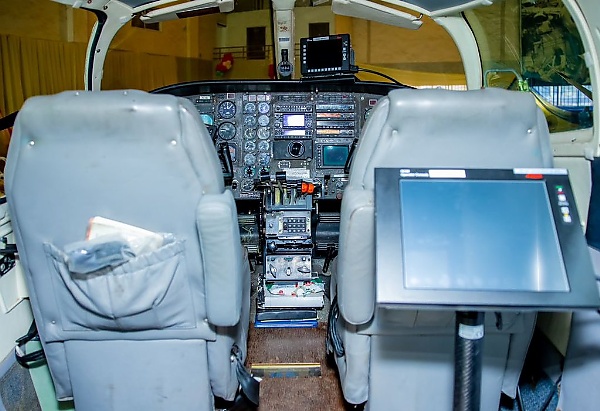
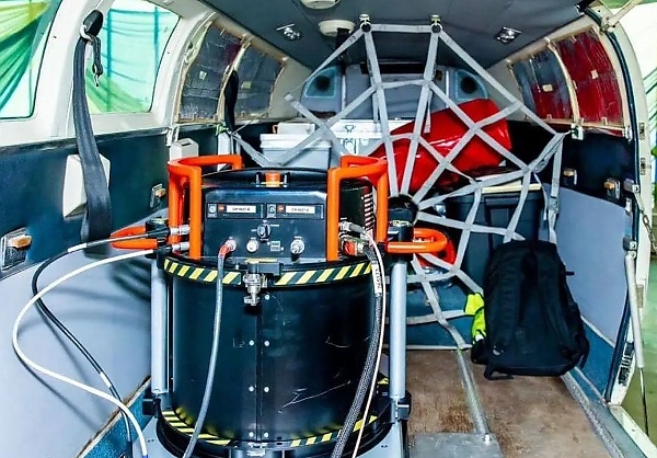
Featuring a huge camera, the aircraft can capture a coin when it flies relatively low at about 4,000ft below sea level.
LASG implores members of the public not to be perturbed by the sight of the aircraft when it’s lowered to get perfect shots.

The Lagos State Government has announced the deployment of a Cessna 406 aircraft for aerial mapping of the state in line with the government’s determination to ascertain the actual figures of buildings and the infrastructural strength of the State.
The Deputy Governor, Dr. Kadri Obafemi Hamzat on Wednesday 15th February inspected the Aerial Survey Aircraft (ASA) at Dominion Hangar, a private hanger, besides Muritala Mohammed International Airport, Ikeja.

For the mapping exercise, the State Government said that the Cessna 406 aircraft will be deployed to take aerial photo shoot of infrastructures and aerial survey throughout the length and breadth of Lagos State.
Speaking during the inspection of the Aerial Survey Aircraft, Hamzat explained that the exercise would be carried out for at least four and half hours daily for about six weeks. Hamzat further highlighted some of the features of the aircraft.

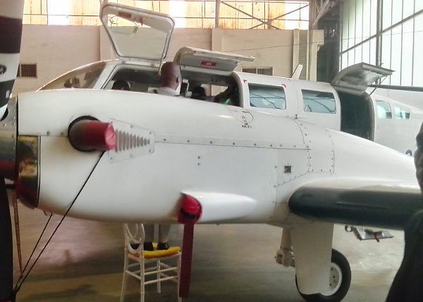
“The aircraft has a huge camera. When it flies it can capture a coin. It flies relatively low at about 4,000ft below sea level. The essence is for it to capture everything that is in Lagos state. It can go and come back. There are layers of flying. The essence for us is to know what is in Lagos. It has a glider that can capture water and land. It would be flying for about four and a half 4 hours daily, depending on the weather.
“We have done it before. Lagos like any other city is dynamic. What we had five years ago is not what you have today. The international standard is to do it every five years so that you can update your database and everything. So, basically, what it does is that you are able to map every inch of soil in your land, and various buildings where you have your allocations and sizes.
“The essence is to know the data of your state and what that does is to enable you to plan. What you cannot really measure, you cannot really manage it. So, the essence for us is to be able to measure every inch of Lagos and its size.”
While announcing the mapping exercise, the State Government implored members of the public not to be perturbed by the sight of the aircraft when it’s lowered to get perfect shots.


-

 News1 week ago
For The First Time, Mercedes Is Using A Chinese Engine In A Vehicle Intended For The European Market
-

 News1 week ago
Nissan Finally Discontinuing The Altima Sedan And Says Why
-

 News1 week ago
Volvo Cars Has Abandoned Its 2026 Growth Objective Because Of Declining Sales In The Chinese Market
-

 News6 days ago
The New Lexus LFA To Be Fitted With Toyota’s Solid-State Batteries
-

 News1 week ago
US Fan Customizes His $5 Million Bugatti Chiron Pur Sport To Honor Messi And Argentina
-

 News1 week ago
ABT Fits The Audi RS3 With An Insane 630 HP
-

 News1 week ago
Opel Set To Build Engines In Algeria
-

 News7 days ago
BYD Group Becomes Official Automotive Partner Of PSG, Players To Receive Denza, BYD Models